
Entropy in the city of Zaragoza. cartography to analyze social diversity and intraurban residential segregation.
Map
DOI:
https://doi.org/10.26754/ojs_geoph/geoph.2023759972Keywords:
entropy, geodemography, residential segregation, urban planningAbstract
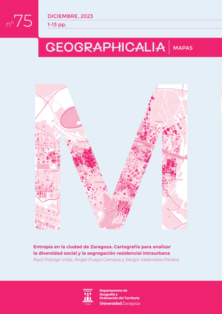
The measurement of social diversity and residential segregation has sparked notable interest in academic, technical, and particularly urban planning circles. However, the reliability of cartographic instruments has been conditioned by the methods and techniques of geodemographic analysis and also by the availability of disaggregated data. This article proposes innovations in the cartographic representation procedure of the entropy index (H2), a multigroup segregation index that enables quantitative and spatial analysis of the residential composition of large groups of foreign population at the block level. The map reveals intraurban contrasts in residential segregation in the city of Zaragoza, employing a multidimensional cartographic representation that combines multiple visual variables, real variables, and instrumental methods to try to understand the complexity of socio-spatial relationships at the intraurban scale.
Downloads
Downloads
Additional Files
Published
How to Cite
Issue
Section
License
Copyright (c) 2023 Geographicalia

This work is licensed under a Creative Commons Attribution-NonCommercial-NoDerivatives 4.0 International License.
- La revista conserva los derechos patrimoniales (copyright) de las obras publicadas, y favorece y permite la reutilización de las mismas bajo la licencia indicada en el punto 2.
- Las obras se publican en la edición electrónica de la revista bajo una licencia Creative Commons Reconocimiento-NoComercial-SinObraDerivada 3.0 España (texto legal). Se pueden copiar, usar, difundir, transmitir y exponer públicamente, siempre que se cite la autoría, la url, y la revista, y no se usen para fines comerciales.
- Los autores están de acuerdo con la licencia de uso utilizada por la revista, con las condiciones de autoarchivo y con la política de acceso abierto.
